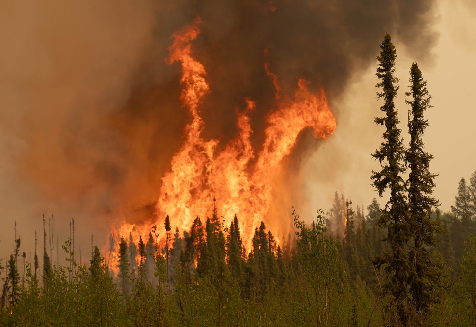
Wildfires in Saskatchewan and Manitoba continue to burn out of control as fierce winds and bone-dry conditions intensify the crisis, forcing evacuations and threatening northern communities.
As of Monday, more than 2.1 million hectares have burned nationwide—already surpassing the annual average for Canada, with summer still weeks away. The hardest-hit regions include northern Saskatchewan and northwestern Manitoba, where relentless northwest winds are pushing smoke, flames and embers across vast swaths of boreal forest and into populated areas.
Evacuation orders remain in place for several communities, including parts of La Ronge, Sask., where flames breached the airport Monday evening. In Manitoba, fires near Flin Flon and Pukatawagan continue to expand, fuelled by gusts of up to 80 km/h and parched fuels on the forest floor.
A stalled low-pressure system over northern Manitoba has drawn in dry Arctic air, maintaining a high fire danger despite cooler-than-average daytime highs. Though wind speeds are expected to ease slightly by Thursday, Environment Canada warns that gusty southerly winds will return by Friday, accompanied by rising temperatures and little to no rain—setting the stage for continued aggressive fire behaviour.
"Long-range spotting is a huge problem right now," said Kyle Brittain, a weather specialist and former wildland firefighter. "With wind-driven embers flying over lakes and firebreaks, communities that appear safe one moment can be in danger the next."
In an interview, Brittain identified La Ronge, Flin Flon, Candle Lake and Pukatawagan among the most at-risk areas. He noted that while some communities are currently seeing fires pushed away by prevailing winds, a shift could bring flames dangerously close in a matter of hours.
"Firefighters are doing everything they can, but in conditions like this, the fire has the upper hand. We need the weather to change—plain and simple," he said.
Satellite imagery confirms widespread fire activity, though thick smoke and cloud cover continue to obscure the full extent of the damage. With access to real-time data limited, emergency management officials are relying on field reports and spotter aircraft to track the rapidly shifting fire front.
Resources remain stretched thin. Crews and equipment have been deployed from across Canada and the United States, but the scale of the fires—combined with the rugged terrain and unpredictable winds—has made containment difficult.
"The season is just beginning, and we've already exceeded the national burn average. It's sobering," said Brittain. "Unless we see a significant pattern shift, this could rival or exceed last year’s historic fire season."
Officials continue to urge residents in fire-prone areas to stay alert and be prepared to leave on short notice as the situation evolves.