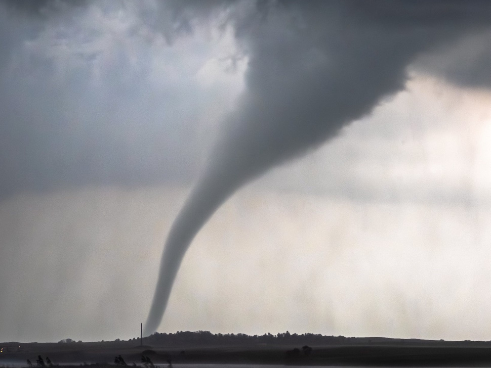
A volatile evening of weather is expected in southwestern Manitoba.
Environment Canada has issued several alerts across the area, including tornado watches and thunderstorm watches and warnings.
Find the latest watches and warnings on our weather page.
As of 4:30 p.m. a tornado watch is in effect for areas of southwestern Manitoba from the U.S. border to Minnedosa, and from the Saskatchewan border to just west of Brandon.
A low over Montana is bringing moisture and heat over southeastern Saskatchewan and southwestern Manitoba which will give a high potential for tornadoes, significant hail, strong winds and torrential precipitation this evening.
Thunderstorms should start late this afternoon and continue throughout the evening and taper off late this evening.
Severe thunderstorm watches are issued when conditions are favourable for the development of thunderstorms capable of producing damaging hail, wind or rain.
"This is a dangerous and potentially life-threatening situation," the agency warned.
Manitobans are encouraged to keep their eyes to the sky and watch for further watches and warnings.
Thursday is calling for clouds in the morning with a 60 percent chance of showers and risk of a thunderstorm. That will all clear late in the afternoon with a high of 25 and a humidex of 31. The rest of the week is expected to be much cooler with highs reaching into the mid-teens.