
A severe thunderstorm system left its mark across southern Manitoba overnight, bringing heavy rain and hail, and causing flooding in parts of Portage la Prairie.
The Manitoba Ag Weather Network reports the following amounts up until 5 a.m. this morning:
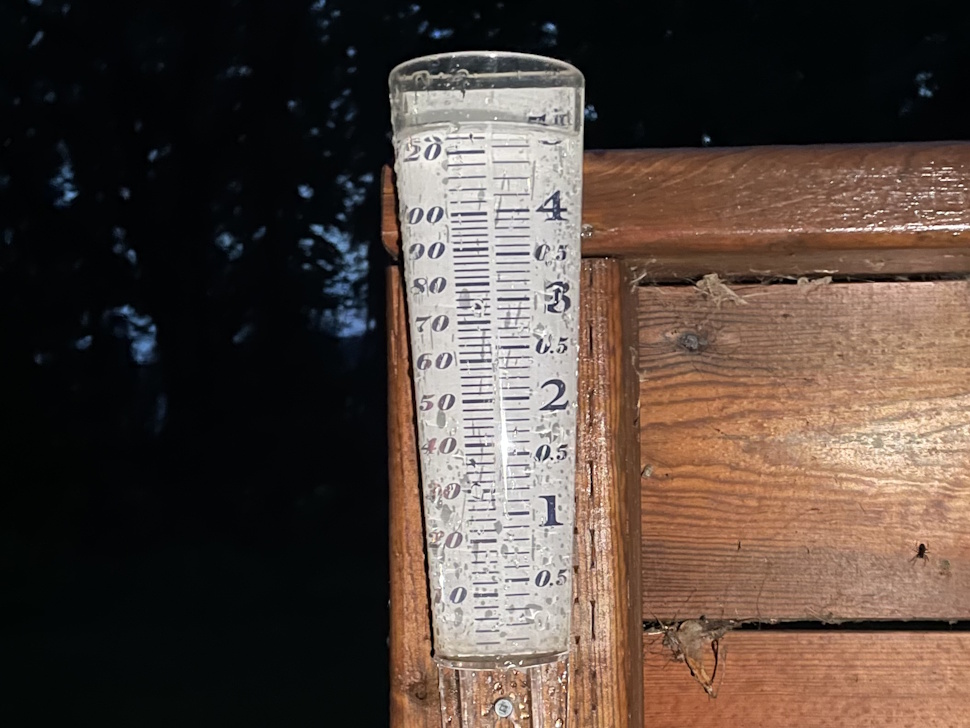
- Portage la Prairie – 98.5 mm ≈ 3.88 in
- Steinbach – 38 mm ≈ 1.50 in
- Elm Creek – 35.1 mm ≈ 1.38 in
- Neepawa – 19.9 mm ≈ 0.78 in
- Gladstone – 13 mm ≈ 0.51 in
- Stonewall – 12.7 mm ≈ 0.50 in
- Plumas – 12.5 mm ≈ 0.49 in
- Morris – 7.6 mm ≈ 0.30 in
- Carman – 3 mm ≈ 0.12 in
- Austin – 2.2 mm ≈ 0.09 in
- Carberry – 1.8 mm ≈ 0.07 in
The downpour was strong enough to overwhelm storm drains in parts of Portage la Prairie. Streets including Crescent Road and Saskatchewan Avenue were underwater early this morning.
There were also several power outages overnight, which continue into Thursday.

Along with the rain, many regions saw a blast of hail. Reports confirm hailstones reaching up to the size of a toonie in the Oakville area.
Meteorologist Keane Kokolsky of Environment and Climate Change Canada says the system originated as a low-pressure system in Montana, which drew in a hot, humid air mass over southern Manitoba.
He explains that the storms stalled over the southeastern part of the province, including Portage, bringing rainfall totals between 70 and 100 mm.
“I actually think you guys are the big winner right now for rainfall amounts, which I’m not sure is good news or not,” Kokolsky notes.
Kokolsky adds that while there was potential for tornadic storms in southwestern Manitoba, none developed as expected.
He also describes the hail and wind conditions overnight:
“Definitely there was some very large hail around the area; near Carmen, near Notre Dame, we did have golf balls there as well.”
Looking ahead, Kokolsky says the cold front sweeping through late this morning and early afternoon could trigger more severe weather, though less intense than overnight.
“Probably some more development for severe weather again this afternoon with the threats being some larger hail and some strong gusty winds and of course, some rainfall,” he explains.
Kokolsky notes the shift in temperatures with the front:
“That system will begin to move off to the east later today and bring in some cooler temperatures and, unfortunately, some more seasonal temperatures. We’re not seeing any kind of summer-like temperatures anymore. It’s more seasonal, low 20s, maybe the high teens there.”
Showers or thunderstorms are expected to end this morning, followed by mostly cloudy skies and a 60 per cent chance of more showers. Conditions should clear this afternoon, though there remains a risk of a severe thunderstorm this morning and again later today. Winds will shift from southeast to southwest and then northwest through the day, gusting up to 50 kilometres per hour, with a high of 25, a humidex of 32, and a moderate UV index of 5.
Tonight will be clear with a low of 13, while Friday calls for sunshine, increasing cloud by late morning, and a 30 per cent chance of afternoon showers. Winds will be strong out of the west, gusting to 60, with a high of 19 and a high UV index of 6.
CLICK HERE FOR THE KITSON'S TOWING WEATHER FORECAST

Sign up to get the latest local news headlines delivered directly to your inbox every afternoon.
Send your news tips, story ideas, pictures, and videos to news@portageonline.com.
PortageOnline encourages you to get your news directly from your trusted source by bookmarking this page and downloading the PortageOnline app.