A violent long-track supercell storm tore across southern Alberta and west-central Saskatchewan on Wednesday, leaving a nearly 400-kilometre swath of damage in its wake and prompting critical alerts across the Prairies.
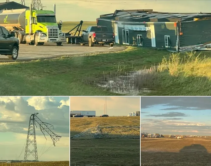
The storm first developed shortly before 3 p.m. near Nanton, Alta., before racing east-southeast at speeds topping 130 km/h. By 5:15 p.m., it had slammed into Brooks, where it toppled power lines, blew a building off a trailer at Highway 1 and 36, and shredded siding from homes and businesses.

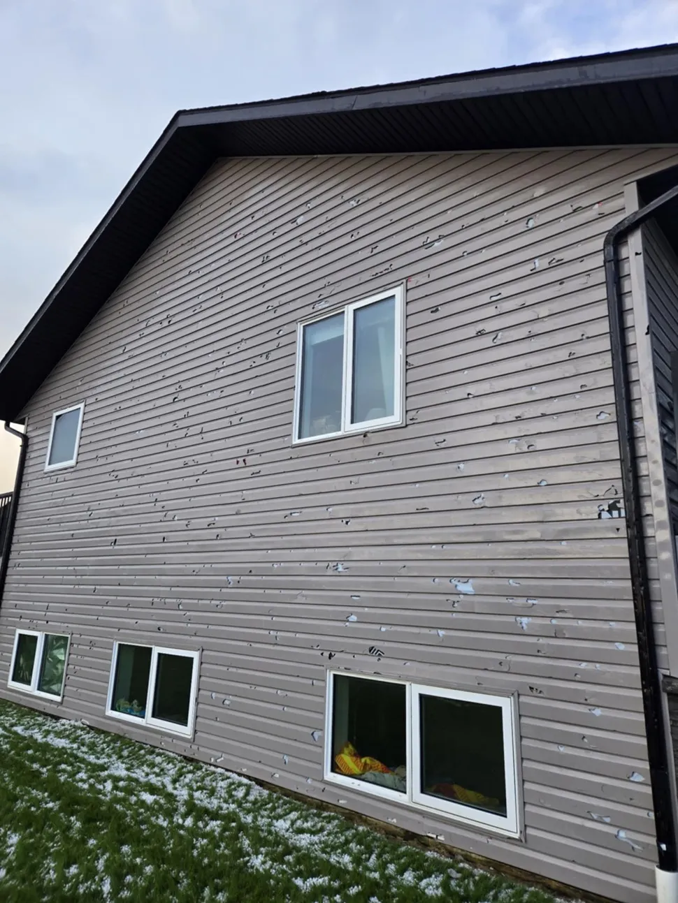
Environment and Climate Change Canada (ECCC) said the system produced damaging winds and hail ranging from loonie to golf-ball size. Power outages were reported across Newell and Vulcan counties, with Fortis Alberta confirming widespread disruptions. Highway 1 between Brooks and Bassano was temporarily closed due to collisions and downed lines.
Peak wind gusts measured as of 10 p.m. included 149 km/h at Atlee, 127 at Lathom, and 113 in Brooks. The agency said the Northern Tornadoes Project and Northern Hail Project will investigate to assess whether wind speeds could be rated on the Enhanced Fujita Scale.
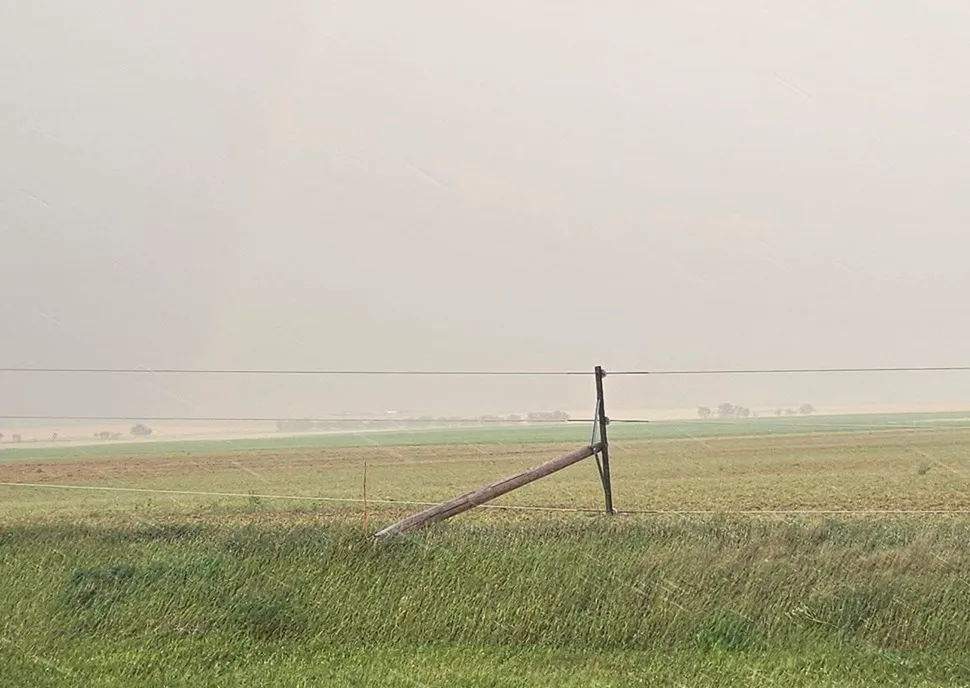
By shortly after 6 p.m., the storm crossed into Saskatchewan near Leader, where it brought down poles, flattened crops and stripped buildings around Mendham. SaskPower said outages in the Leader area were extensive but expected to be repaired by Thursday afternoon.

The supercell tracked northeast through Elrose and north of Saskatoon, triggering a tornado warning near Warman before continuing into the Wadena region late in the evening. No serious injuries were reported, but widespread property and crop damage has emerged along its path.
“This was one of the most severe and longest-track storms of the summer,” said Environment Canada in its summary, adding it is still collecting reports of damage.
Meanwhile, additional supercells erupted in west-central Saskatchewan. Storm chaser Hank Vlietstra of Wilkie said a storm developed earlier than expected over his community, dropping nickel-sized hail that bounced more than 15 feet off driveways.
Here’s a local #cat caught in a #hailstorm today#skstorm pic.twitter.com/INIo9eh1GG
— Hank Vlietstra (@FlatlanderHank) August 21, 2025
“It took me by surprise,” Vlietstra said. “I was expecting storms around 7 or 8 p.m., but by 5 o’clock we had one right over top of us.”
The Wilkie storm never reached tornado-warned status, but a neighbouring system veered into North Battleford, pelting the city with egg-sized hail. Environment Canada later issued a tornado warning as the storm rotated and tracked east toward Humboldt.

“It was rotating for sure and deserved that tornado warning,” Vlietstra said, noting he has chased storms for more than a decade. “For many communities, this was the most talked-about stormy evening of the entire summer.”
Vlietstra said he saw photos of hail north of North Battleford nearly the size of baseballs.
Around Kindersley heavy winds and a torrential downpour hit but no large hail reports were made
Though tornadoes have not yet been confirmed, Wednesday’s events added to a summer of volatile weather across the Prairies.
ECCC is asking residents to submit damage reports, photos or video to aid in its investigation.
