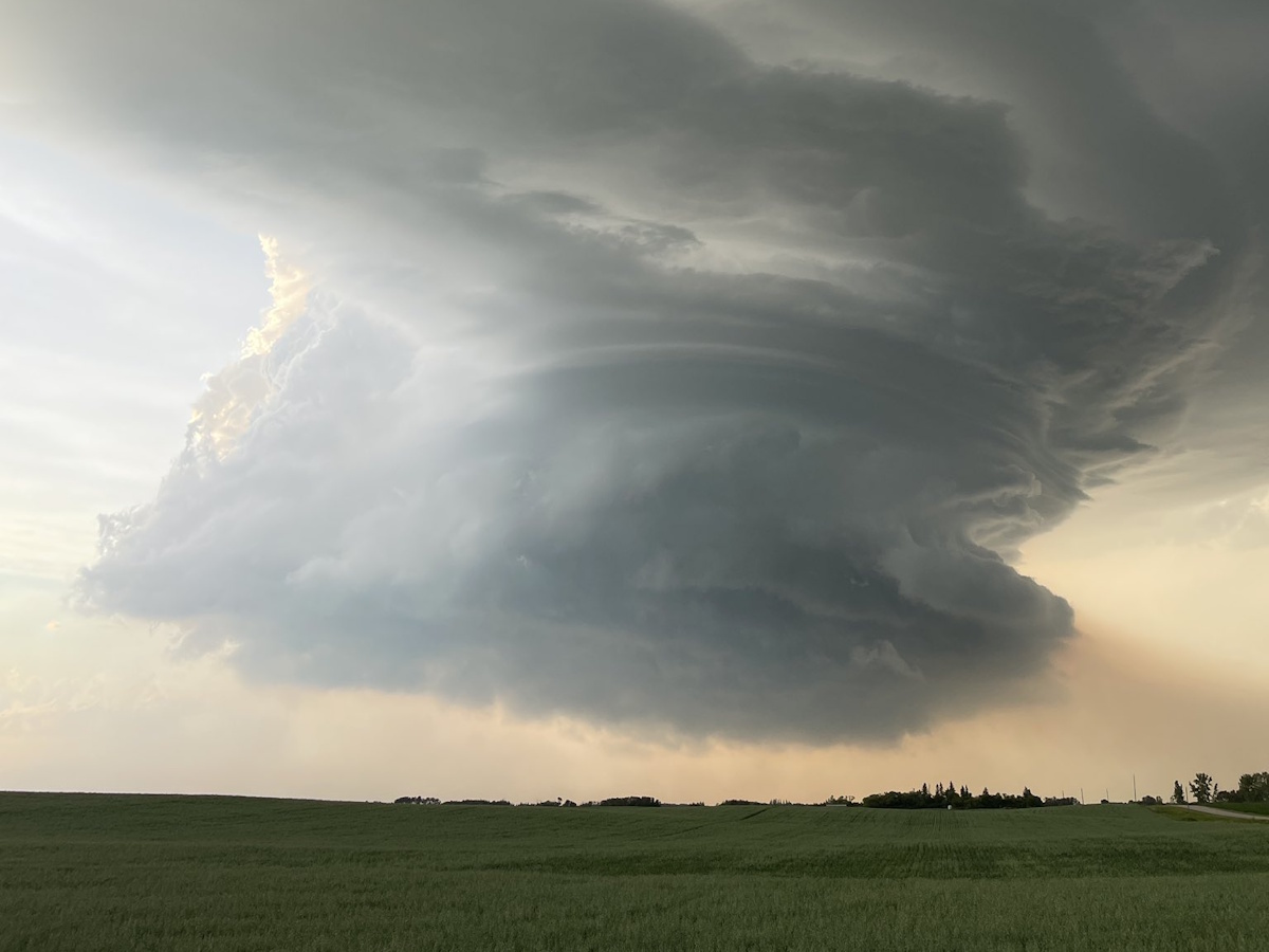
It was a stormy evening for some pockets of Western Manitoba with several Tornado Warnings and Severe Thunderstorm Warnings issued Thursday night.
Both the Municipality of Boissevain-Morton and Cartwright-Roblin had Tornado Warnings issued mid-evening with Environment Canada indicating the particular storm cell which travelled over those regions was showing rotation on RADAR. Several storm chasers on the ground also reported on social media it was rotating, and one indicated a funnel cloud briefly extended downward from the cell while it was northwest of Boissevain.
Toonie to Ping Pong size hail was reported west of Neelin.
Get your five day forecast, here
Our DiscoverWestman Rainwatchers indicate totals were minimal and spotty last night; Killarney had 7mm; Ninette 6.4mm, Boissevain 1.1m, Glenboro 2.0mm and Souris 1.5mm.
An Air Quality Warning is in effect for all of Southwestern Manitoba today, as wildfire smoke from northern Manitoba and Saskatchewan has descended into the region behind the cold front which swept through yesterday.
We're expecting a cloudy day in Westman, with a 60 per cent chance of showers and the risk of a thunderstorm and highs around 20 degrees.
July 10, 2025 - 852pm - 6 miles east of Holmfield MB #mbstorm pic.twitter.com/4BESXdMsL4
— Dustin Freeman (@DusterMB) July 11, 2025