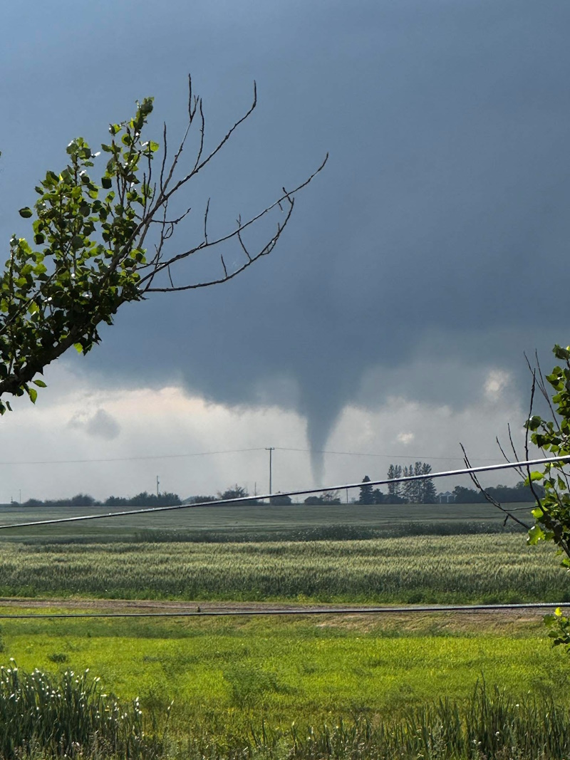
The stretch south of the number 16 highway near Allan was the track for another tornado sighting this weekend as some turbulent weather rolled through Saskatchewan. Eyewitnesses and storm trackers caught sight of a funnel cloud that seemed to have touched down near the community southwest of Humboldt.
It’s the third occasion this summer for twisters to have been seen developing in the corridor between Highways 15 and 16. Environment Canada meteorologist Crawford Luke says that investigation into a potential touchdown of one, and possibly two, tornados is ongoing, but thus far, no damage was reported on Sunday.
“Nothing is confirmed at this time. It looks likely that at least one will be confirmed, but not yet. There’s no damage confirmed from the weather, which doesn’t mean it hasn’t happened – it just means we haven’t heard of any yet.”
Allan wasn’t the only place in the province to produce a possible tornado, says Luke. Near Cadillac, directly south of Swift Current, another was spotted on Saturday afternoon. Luke says photographic evidence was not conclusive, but Environment and Climate Change Canada awaits further visual confirmations.
The two-pronged system crossed into Saskatchewan from Alberta and Montana on Saturday sparking a line of thunderstorms south of the Trans-Canada number one from the Cypress Hills across to southeastern Saskatchewan. That stretch produced more widespread heavy rainfalls with many areas reporting over 25 mm.
The second belt of storms came in from west of Saskatoon with the most intense cells tracking along the aforementioned path near Allan and Young. Thunder was also present throughout the Humboldt region, but heavier rainfall was sporadic.
“There’s a stripe along Highway 13 in the south where there is a lot of rainfall from the weekend. A couple of stations in the southwest were along the 50 – 60 mm range of rainfall in Shaunavon and Hazenmore.”
Other locales may have seen even more intense rainfalls based on the radar mapping, says Luke.
The tail ends of the weekend system are expected to move out today with a lingering chance of showers over the next couple of days, and a return to drier weather mid-week.
