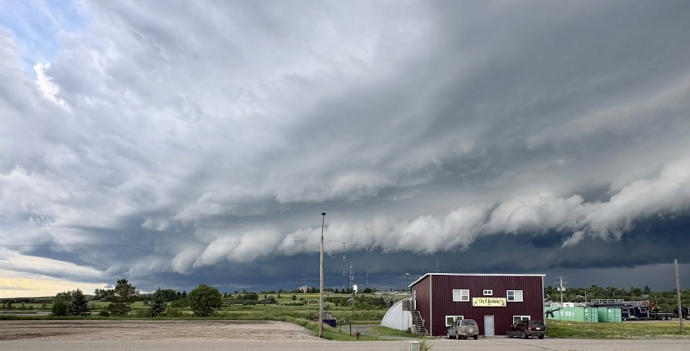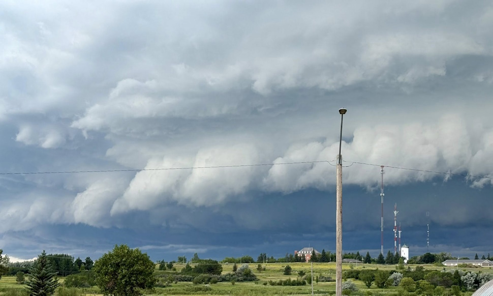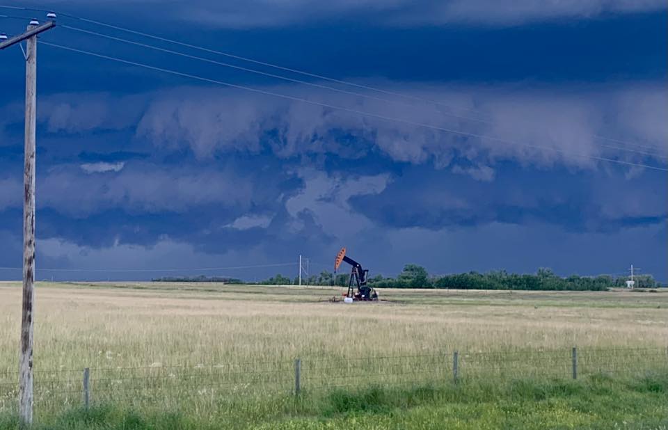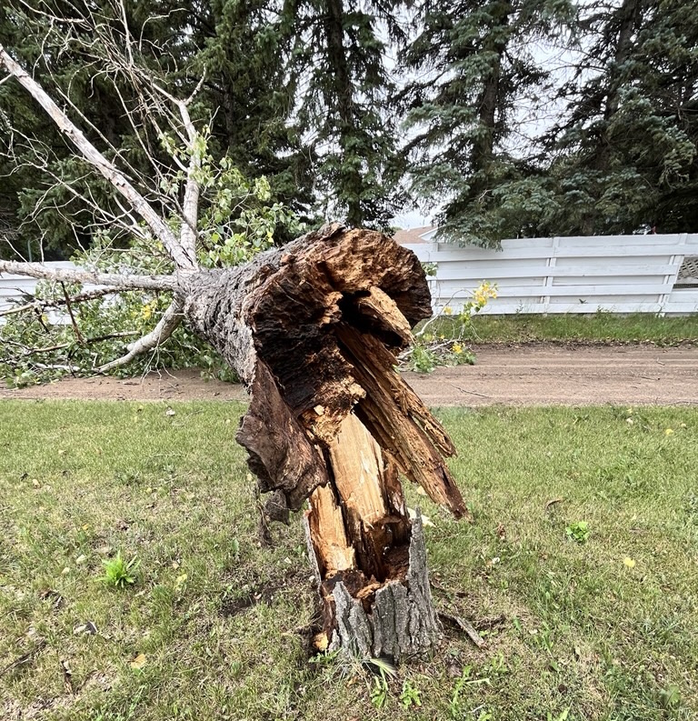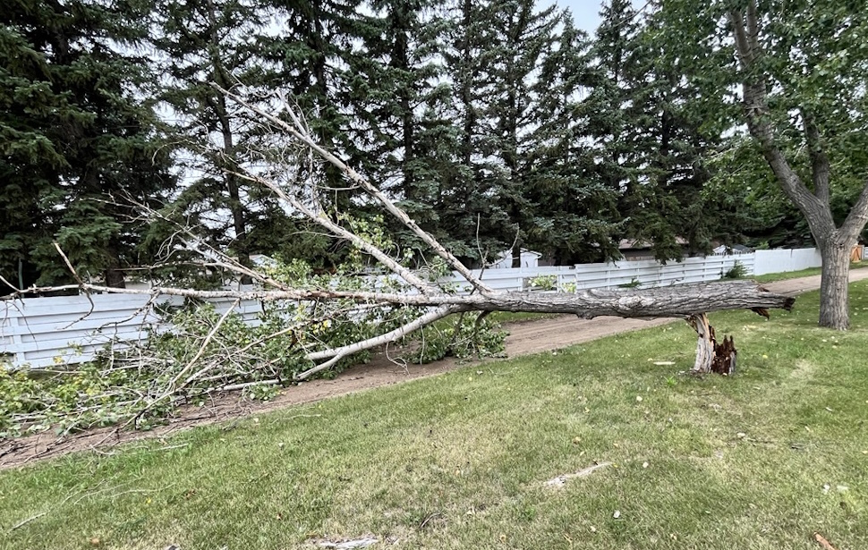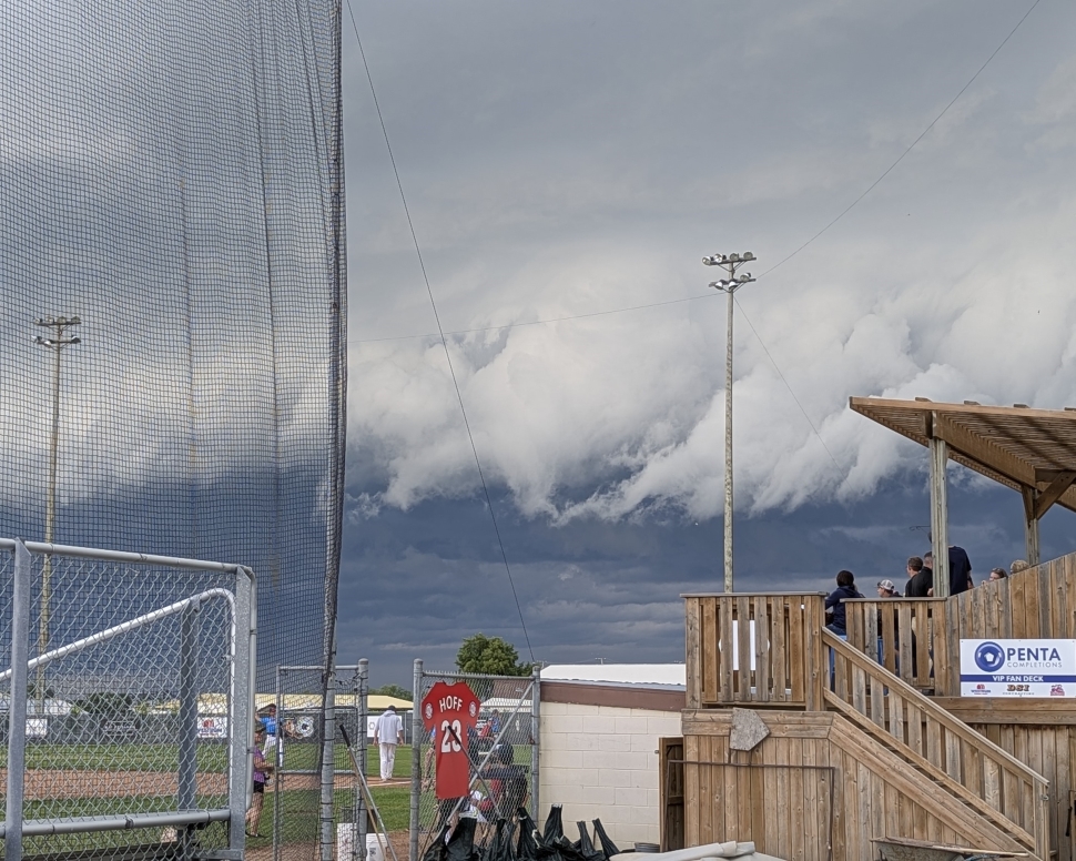
Severe thunderstorms moved through southern Saskatchewan Sunday night, the second night in a row of active weather. Around 7 p.m., the system made its way to Weyburn, where it showed some rotation, but no funnel clouds were reported. The storm, which lasted around 45 minutes, dumped 12.8 millimetres of rain on the city and had sustained wind speeds of 60.2 kilometres per hour, according to Environment and Climate Change Canada data. The storm also culminated what was a wet weekend for Weyburn, with a total of 26 millimetres falling on the city.
Despite the appearance of the storm as it approached Weyburn and other cells associated with the front that passed through, there were few reports to Environment and Climate Change Canada about the storm.
“We don't really have a lot of reports coming out of that area from last night,” said Crawford Luke, a meteorologist with ECCC. “I kind of suspect there probably was some hail; there might have been some wind, but we just haven't heard of anything yet.”
The system that triggered the storms near Weyburn also triggered storms across a large part of the province, though, with a potential tornado being reported near Saskatoon and Allan. This reported tornado is currently being investigated by Environment and Climate Change Canada.
The rainfall that did come this weekend could also result in a feedback loop of sorts, at least for a day or two. One of the key ingredients for the development of thunderstorms is moisture, which southern Saskatchewan received plenty of over the weekend. The other is heat, which is expected today and tomorrow.
“It looks like tonight, you know, probably after midnight will be the better chance for thunderstorms,” Luke explained. “But we could get into some pretty active thunderstorms overnight tonight. Could be looking at hail, especially, but maybe even wind and another round of heavy rain with those as well. And then maybe even looking at thunderstorms again tomorrow in the afternoon.”
There is a break expected in the active weather starting on Wednesday, but then hotter temperatures expected for the weekend could see the active weather resuming here in the southeast corner of the province.
When there is severe weather, there is only so much the radar and other data can show. Often, those who investigate severe weather need some help from the public in terms of confirming what they are seeing on radar.
“If people are on X and they want to send a tweet with the hashtag #SKStorm, that's a good way to share reports with the weather office," Luke noted. "Emailing is also another option, which is really good. So, you can email skstorm@ec.gc.ca.”
“Any report we get, we're always so appreciative,” Luke added. “It really helps give us an idea of what's happening on the ground when we see something on radar, for example. And yeah, we really, really do appreciate those reports so much. They're so invaluable to us.”
You can stay up to date with the latest forecast by visiting the Discover Weyburn Weather page.