Original alert from SaskAlert below.
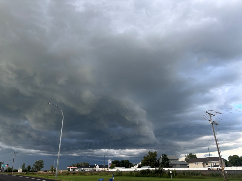
Environment Canada meteorologists are tracking a severe thunderstorm.
At 4:55 PM CST Doppler RADAR indicated that this severe thunderstorm was located about 10 km east of Tribune and was moving toward the northeast at 30 km/h.
The main threats from this severe thunderstorm will be:
- hail to the size of baseballs
- wind gusts to 110 km/h
At 4:39 PM CST spotters reported tennis ball sized hail with this thunderstorm.
This is a dangerous thunderstorm with very large hail!
Large hail will cause significant damage and injury.
Severe thunderstorm warnings are issued when imminent or occurring thunderstorms are expected to produce damaging hail, wind or rain.
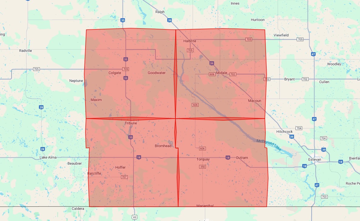
Affected Areas (4)
- R.M. of Cambria including Torquay and Outram
- R.M. of Cymri including Midale Macoun and Halbrite
- R.M. of Lomond including Colgate and Goodwater
- R.M. of Souris Valley including Tribune and Oungre
Instructions
- Take immediate cover if a thunderstorm approaches.
- If outside, protect yourself from flying debris and hail.
When Are Thunderstorm Alerts Issued?
National, except Nunavik
When conditions are favourable for the development of severe thunderstorms with one or more of the following conditions:
- Wind gusts of 90 km/h or greater, which could cause structural wind damage;
- Hail of two centimeters (cm) or larger in diameter; or
- Heavy rainfall, as per rainfall criteria, excluding those for winter and during thaw.