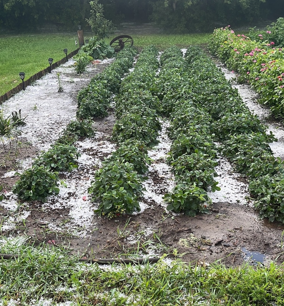
An intense thunderstorm system caused significant rainfall, damaging winds, and hail to pelt communities across southeast Saskatchewan. Meteorologist with Environment and Climate Change Canada, Crawford Luke, says they heard reports of tennis-ball-sized hail near Torquay, with accumulations of smaller-sized hail in Midale.
“Low pressure was sitting over the southern part of the province, and a bunch of showers were circulating it, and then in that low southeast of the province, we had this complex of thunderstorms fire up right on the international border."
The wind and hail caused significant property damage, with garages and sheet-metal-covered buildings seeing the most impact. Alongside damage to roofing materials, and fallen and broken trees.

Luke explains that the damage was likely due to high wind speeds as opposed to tornadic activity.
“This would definitely take some pretty strong winds, certainly over 100 kilometers an hour, or much stronger than that even. Our current thinking is that this was likely not a tornado, but rather just straight line winds from a thunderstorm.”
“That should not diminish at all the damage of the storm that struck the area because this was a pretty intense storm. And whether it's straight line winds or a tornado the damage is still the same."
Hail size and intensity varied from area to area. Luke says this is influenced by a number of factors, including the speed of the storm as the smaller-sized hail that accumulated into piles would have required a slow moving thunderstorm. He continues saying hail types can vary even within the same system.
“Thunderstorms go through a life cycle of their own. Depending if they're at a certain stage in their life cycle versus another stage, that could decide if there's some large hail or some small hail. But also, sometimes within the same thunderstorm, there'll be different sized hail in the updraft. It's actually quite common, especially when there is large hail, it's quite common to still get some smaller hail as well.”
Luke explains that in that circumstance, the larger hail will typically fall out of one side of the storm, whereas the smaller hail falls out the other side. This relates to the weight of the hailstones and how far it travels after its thrown from the storm.
While the potential for rain and thunderstorms are forecasted to continue this afternoon, there is an expected reprieve for the rest of the week.
“Once we get through today it definitely looks like it's going to be a beautiful rest of the week. Air quality has really improved, temperatures right where they should be for this time of year, and a lot of sunshine for the next few days. We might get into some more chances for thunderstorms later this week and into the weekend as it approaches but the next few days certainly looks like it's sunny and warm and just beautiful summer weather.”
Stay up to date on current weather conditions on the DiscoverWeyburn weather page.