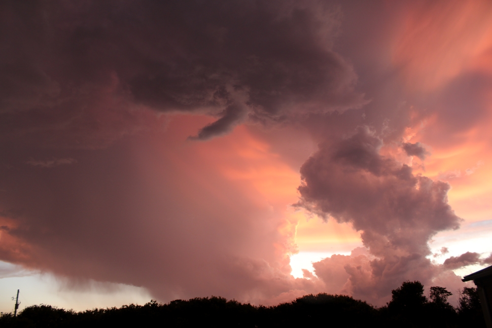
Thunderstorms moving through southeast Saskatchewan Sunday afternoon prompted several reports of funnel clouds in teh Weyburn area. The storms also brought spotty, intense rainfall in some areas, while others received just a trace amount. The storms, however, have set the stage for what could be a hot and humid week.
Environment and Climate Change Canada is investigating the reports of the funnel clouds as potential tornadoes; however, none of them have been confirmed as of yet to have touched down, and no damage has been reported.
“North and south of Weyburn is where we saw some of these funnel cloud reports come in from,” explained Crawford Luke, a meteorologist with Environment Canada. Some of the reports came from Colfax, just west of Highway 35 along Highway 306. “Later in the evening, there was a storm that produced another funnel cloud. This time it was south of Weyburn. This was in Tribune.”
The storms also brought some heavy rains to some areas. Golfers at the Weyburn Golf Club were sent scrambling for the clubhouse as a torrential downpour started around 4 p.m. Nickle Lake also had a heavy downpour. At the same time, some areas, mere kilometres away, saw very little rainfall during the afternoon.
“The highest rainfall amount we have from a rain gauge in the area is eight millimetres of rain,” Luke reported, noting this gauge was in Francis. “Weyburn itself, our weather station there was (reporting) 0.5 millimetres. Looking at the radar estimates here, it kind of ranges from nothing up to 40 millimetres of rain, so it really kind of depends on where you were relative to the storm.”
With the storms now gone, there is an increase in the humidity in the region, which will lead to a different situation, weather-wise, than the storms over the weekend.
“It looks like we're staying humid and warm,” Luke explained. “It looks like it’s definitely going to be into a hot air mass for today through at least the middle part of this week.”
Temperatures will get into the 30s, with the humidex values making it feel closer to the 40s. When temperatures start to get that warm, advisories of a different sort start to be issued.
“I wouldn't be surprised if we saw heat warnings come out maybe later today or tomorrow for this Tuesday, Wednesday heat," Luke advised. “Stay hydrated, take it easy. If you're working outside, try to take a few more breaks and all that kind of stuff.”
You can stay up to date with the latest forecasts on the Discover Weyburn Weather page.