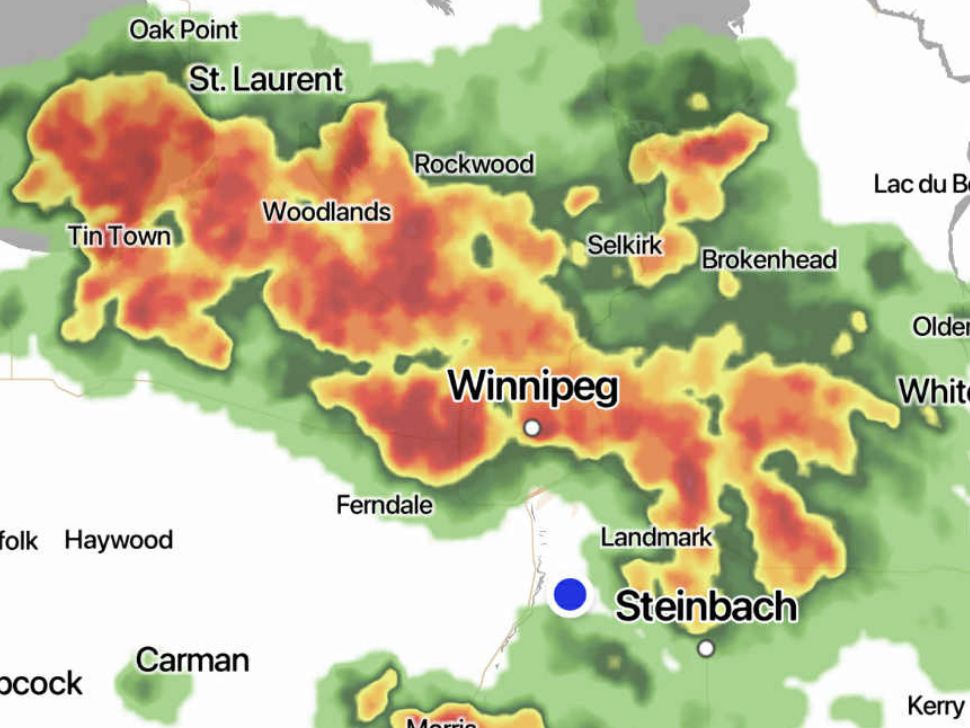
The storm isn't finished just yet as another wave of severe thunderstorms rolls through southern Manitoba early Thursday morning.
UPDATE: The severe thunderstorm watch for Winnipeg ended at 6:33 a.m.
Previously:
"We're not out of the woods just yet," says Keane Kokolsky, a meteorologist from Environment and Climate Change Canada (EC). "Severe thunderstorm watches do remain in effect for most of southern Manitoba."
There is another cold front moving through the southern region, including Winnipeg, on Thursday afternoon that could bring even more storms.
According to Manitoba Storm Watch, there were over 1,800 lightning strikes by 2:00 a.m. on Aug. 21 in the Winnipeg and Portage la Prairie area alone.
"The rainfall and thunderstorms we're experiencing right now over the southeast are the result of a warm front and a system that's come out of Montana."
Kokolsky says the system isn't moving quickly, causing some areas to have flash flooding and intense rainfall.
"We're going to continue to see these thunderstorms develop through the morning and into the early afternoon over us before they begin to taper off."
EC says driving conditions may be difficult. There can be significant damage to property, buildings, and trees. People should be aware that fast-moving and rapidly rising water can sweep vehicles away and damage infrastructure.
While there was a tornado warning in the southwest corner of Manitoba late Wednesday, nothing formed, according to EC.
