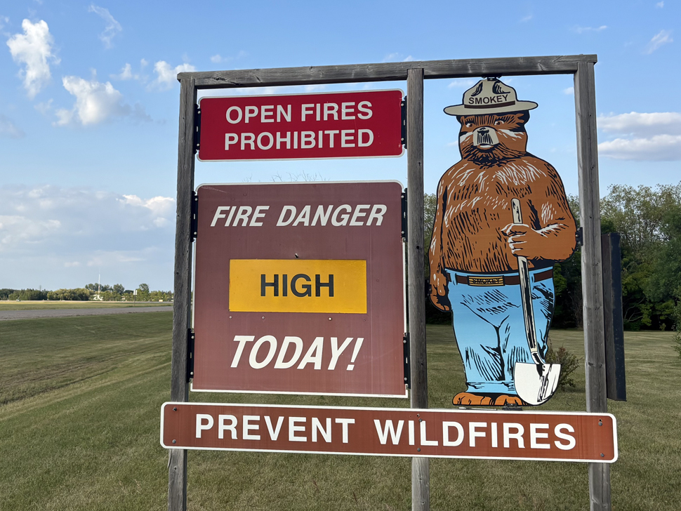
The Manitoba Wildfire Service advises that fire danger remains high to very high across much of the province today.
A number of communities have made the decision to evacuate due to the risk of wildfire, loss of road access due to wildfires or smoke. This includes Nisichawayasihk Cree Nation and people with health conditions from Little Grand Rapids First Nation and O-Pipon-Na-Piwin Cree Nation (South Indian Lake). Other communities have been able to begin the process of returning home, such as Pimicikamak Cree Nation (Cross Lake) and Tataskweyak Cree Nation (Split Lake).
Manitoba Wildfire Service has cancelled all burn permits for the Burn Permit Area, with no new burn permits issued at this time. Land based travel is permitted, unless closed by Parks or other closure orders. Those entering a fire boundary by aircraft will require a travel permit. To view active fire boundary maps, visit www.gov.mb.ca/conservation_fire/Fire-Maps/fireview/fireview_map.html. To apply for a travel permit, contact a Natural Resources and Indigenous Futures district office and visit www.gov.mb.ca/nrnd/co/index.html to find a location.
Manitoba remains under a provincial state of emergency, under the Emergency Measures Act due to a wildfire season that is now the worst on record in the last 30 years, with more than 1.55 million hectares (ha) of area burned in the province. The state of emergency is in effect until Aug. 8 and if necessary, may be extended.
For updates on park closures, visit www.manitobaparks.com.
Fires of note
The Manitoba Wildfire Service continues to respond to 165 active wildfires across the province, a total of 401 wildfires to date, well above the average for this date of 299 total fires.
Fires of note include:
East region:
- Fire EA061 remains out of control at approximately 331,800 ha. A closure and mandatory evacuation order is in place for most of Atikaki Provincial Park, and the entire areas of Wallace Lake and South Atikaki provincial parks. While access to Nopiming Provincial Park has reopened, the fire continues to smoulder throughout the park.
West region:
- Fire WE017, located near Sherridon and the city of Flin Flon, is approximately 347,100 ha and is out of control. For the safety of personnel, boaters are asked to avoid waterways being utilized by Manitoba Wildfire Service tankers and aircraft.
- Fire WE025, located near Mathias Colomb Cree Nation (Pukatawagan), is approximately 62,075 ha and is being monitored. The fire is contained around Mathias Colomb Cree Nation (Pukatawagan) but a mandatory evacuation order continues.
- Fire WE028, located 10 kilometres (km) from Bakers Narrows Provincial Park, is approximately 7,190 ha and is out of control.
- Fire WE052 and WE053, located near Snow Lake have merged and are now collectively labelled as WE052. This fire is approximately 57,800 ha and is out of control.
- Fire WE085, located about 9 km from Cormorant, is approximately 4,900 ha and is out of control. A mandatory evacuation order is in place.
North region:
- Fire NO002, located near the town of Lynn Lake, is approximately 84,270 ha and is out of control.
- Fire NO042, located 12 km southwest from the town of Lynn Lake, is approximately 15,090 ha and is out of control. A mandatory evacuation order is in place for the town of Lynn Lake and Marcel Columb First Nation.
- Fire NO005, located near Pimicikamak Cree Nation (Cross Lake), the Incorporated Community of Cross Lake, Jenpeg Generating Station and Whiskey Jack Landing, is approximately 149,560 ha and is out of control.
- Fire NO010, located near Tataskweyak Cree Nation (Split Lake), is approximately 25,225 ha and is out of control.
- Fire NO026, at the town of Leaf Rapids, is approximately 73,540 ha and is out of control. A mandatory evacuation order is in place for the town of Leaf Rapids.
- Fire NO047, located 25 km from the town of Leaf Rapids, is approximately 15,525 ha and is out of control.
- Fire NO061, located 14 km from the city of Thompson, is approximately 18,365 ha and is out of control.
- Fire NO079 located near Kistiganwacheeng (Garden Hill Anisininew Nation), is approximately 37,855 ha and is out of control.
Information and resources for evacuees
The primary evacuation reception centre in Winnipeg is located on the third level of the RBC Convention Centre at 375 York Ave. Evacuees can attend this location to register with the Canadian Red Cross, and to access supports and services. Evacuees can also call 1 (800) 863-6582.
In response to the need for shelter for wildfire evacuees, Emergency Social Services continues to work with the Canadian Red Cross to operate congregate shelters in Winnipeg at the RBC Convention Centre at 375 York Ave and the Leila Soccer Complex at 770 Leila Ave.
For the safety of both evacuees and frontline and firefighting personnel, the province is reminding Manitobans not to enter areas under a mandatory evacuation until local authorities identify the situation is safe and evacuees are able to return.
The Manitoba Emergency Management Organization recommends evacuees leaving their communities due to wildfire bring their medications, identification, phone chargers, important documents, any needed baby supplies and a change of clothing.
Visit MBReady at https://mbready.manitoba.ca for more information about emergency alerts and safety, as well as resources for evacuees such as:
- financial support: https://gov.mb.ca/wildfire/evacuees.html#financial-support
- emergency shelters: https://gov.mb.ca/wildfire/evacuees.html#shelter
- health resources: https://gov.mb.ca/wildfire/evacuees.html#health-resources
- insurance: https://gov.mb.ca/wildfire/evacuees.html#insurance
- returning home: https://manitoba.ca/wildfire/evacuees.html#community-re-entry
All Manitobans returning to reopened areas are advised to be prepared to evacuate again with little notice and should prepare an emergency go kit. More information on emergency preparedness, including what to include in an emergency go kit, is available at www.gov.mb.ca/emo/guide/individuals.
For assistance, evacuees can dial Manitoba 211 from anywhere in Manitoba or email 211mb@findhelp.ca. For more information, visit https://mb.211.ca/get-help-now/.
General wildfire information
- latest road conditions and closures: www.manitoba511.ca
- burn restrictions for municipalities: www.manitoba.ca/wildfire/burn_conditions.html
- important Manitoba wildfire information: www.manitoba.ca/wildfire
- emergency preparedness information including what to include in an emergency go kit: www.gov.mb.ca/emo/guide/individuals
- follow the Manitoba government on X (formerly Twitter) at https://twitter.com/mbgov
To report a wildfire, call 911 or the TIP line toll-free at 1-800-782-0076.