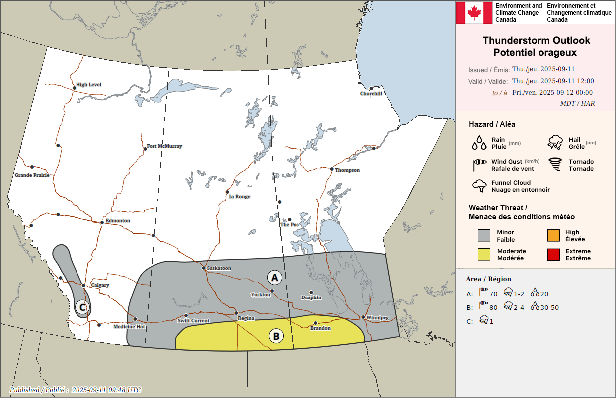
Environment and Climate Change Canada says parts of southern Saskatchewan could see severe thunderstorms Thursday evening as a warm front lifts north of the U.S. border.
Elevated thunderstorms developed overnight in southern Saskatchewan and continued into Wednesday morning. Some storms in the southeast brought heavy rain and hail.
As the front moves north late Thursday, surface-based storms could develop near the Saskatchewan–U.S. border. These storms carry a slight risk of becoming severe. Showers and non-severe thunderstorms are also expected to spread into southern Manitoba Thursday.
Meteorological fall began on September 1, and while severe storms are less common in the fall months, they do happen. Last year, two late-season tornadoes were confirmed in southeast Saskatchewan on September 18, 2024. Both were rated EF1 and caused damage to trees, homes, and farm structures near Vandura and Poplar Grove. As the front moves north late Thursday, surface-based storms could develop near the Saskatchewan–U.S. border. These storms carry a slight risk of becoming severe.
Environment Canada says out-of-season thunderstorm outlooks will continue to be issued as needed.
