Update: Environment Canada has issued a tornado warning in the southeast as of 2:48 p.m., with a storm located southwest of Carlyle, moving southeast at 20 km/h.
They urge people in the area to take cover immediately if threatening weather approaches. We'll have any more updates as they become available.
The original article continues below.
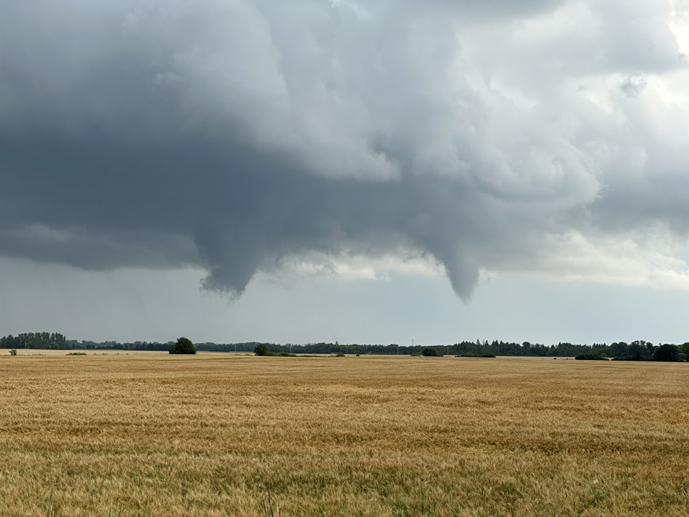
As today's weather system is progressing, Environment and Climate Change Canada has sent out a special weather statement for southeastern Saskatchewan and southwestern Manitoba.
In the statement, they urge people to watch out for funnel clouds developing during the current storm system, which could lead to landspout tornadoes.
Scientist Christy Climenhaga explains the current weather environment in the southeast.
"What we're seeing is an environment that's fairly unstable, lots of moisture, but also a little bit of vorticity, a little bit of rotation possible in these storms that develop in the extreme southeast this afternoon."
As we head through the day, Climenhaga says people will need to keep an eye on the sky.
"It's probably likely through more of the afternoon hours. Of course, we do have a few thunderstorms, a few showers rolling through the very extreme south of Saskatchewan, and mostly showery weather. So it's something to probably watch as we make our way into the afternoon hours, more so."
While landspout tornadoes aren't the most damaging, Climenhaga still recommends people take proper precautions during the storm.
"Landspout tornadoes often don't cause significant damage, but they can still be dangerous. So if you do see a funnel, you want to give it some space. Of course, if a watch or warning, especially if a tornado warning pops up for your region, that is when you want to take cover in the most central room of your house or basement if possible."
If conditions become more favourable for the development of landspout tornadoes, Environment and Climate Change Canada says they will issue watches and warnings as necessary.